Did Ancient Civilizations Map Antarctica Before Modern Discovery?
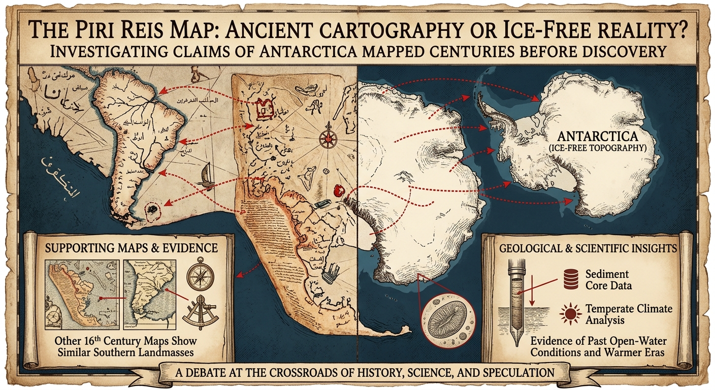
The Piri Reis Map of 1513 continues to puzzle historians, geographers, and researchers around the world. At first glance, it appears to be just another early world map. But a closer look reveals something deeply intriguing—what some believe to be a depiction of Antarctica’s coastline, drawn centuries before its official discovery in 1820.
A Map That Shouldn’t Exist?
The map, created by Ottoman admiral Piri Reis, is said to have been compiled using even older source materials. What makes it controversial is the claim that it shows parts of Antarctica without ice—something that modern science suggests hasn’t been possible for millions of years.
If true, this would imply that the original data used to create the map came from a time when Antarctica was accessible and possibly even inhabited or explored.
Supporting Evidence from Other Maps
Interestingly, the Piri Reis map is not alone. Other 16th-century cartographers, such as Orontius Finaeus and Giacomo Gastaldi, produced maps that appear to show similar southern landmasses with surprising accuracy.
The consistency across these maps suggests that they may have all relied on a common, much older source—one that has since been lost to history.
What Science Says About Antarctica’s Past
Geological studies add another layer to the mystery. Research from the Ross Sea has revealed sediment cores indicating that parts of Antarctica may have experienced open-water conditions as recently as 6,000 years ago.
Additionally, a 2012 study suggested that some regions may have had temperate climates around 12,000 years ago. While these findings don’t confirm ancient civilizations, they challenge the long-held belief that Antarctica has been completely frozen for tens of millions of years.
The Question of Restricted Exploration
Another aspect often discussed is the limited accessibility of Antarctica. Governed by the Antarctic Treaty System, the continent is heavily regulated, with strict controls on exploration and activity.
Some researchers argue that these restrictions have led to a lack of deeper investigation into anomalies such as subglacial lakes like Lake Vostok. Hidden beneath miles of ice, Lake Vostok remains one of the least explored environments on Earth.
Coincidence, Misinterpretation, or Lost Knowledge?
Skeptics argue that the supposed Antarctic coastline on these maps may actually represent distorted versions of South America. Early cartographers often struggled with scale and geography, leading to inaccuracies that can be misinterpreted today.
However, supporters of the alternative theory believe the level of detail is too precise to dismiss as coincidence.
Final Thoughts
The mystery of the Piri Reis map sits at the crossroads of history, science, and speculation. Whether it represents misunderstood cartography or evidence of lost ancient knowledge, one thing is certain—it challenges our understanding of human history and exploration.
As research continues and technology advances, we may one day uncover the truth behind these ancient maps. Until then, the question remains open: Did someone map Antarctica long before modern civilization even knew it existed?